
Needing a break from the … everything … and having our planned Hawaii trip postponed thanks to raging COVID, we decided to fulfill one of my long-time goals – visiting the wonderfully named Great Dismal Swamp – and see a few of the many other wildlife refuges in the general neighborhood of the GDS. Virginia Beach would be our base of operations.
Note: if you believe we’re still in the midst of a pandemic (hint: we absolutely are), don’t go to Virginia Beach, Norfolk or anywhere in the vicinity. Almost no one wears a mask in any situation. Also, the Hilton Hotel, and likely others in the area, was having major staffing issues with an apparent inability to fulfill many commitments (they did reduce our bill). On the other hand, do visit Katie’s 33rd Street Café on the boardwalk for breakfast. Outstanding.
Here is breakfast at Katie’s and the outdoor seating area early on a Sunday:


Eastern Shore of Virginia Wildlife Refuge
Visited on the way down, a fortunate decision since there was relatively little to see. This refuge comprises 1,127-acres in Northampton County at the southern end of the Eastern Shore and near the tip of the Delmarva Peninsula. You can skip it without missing much.


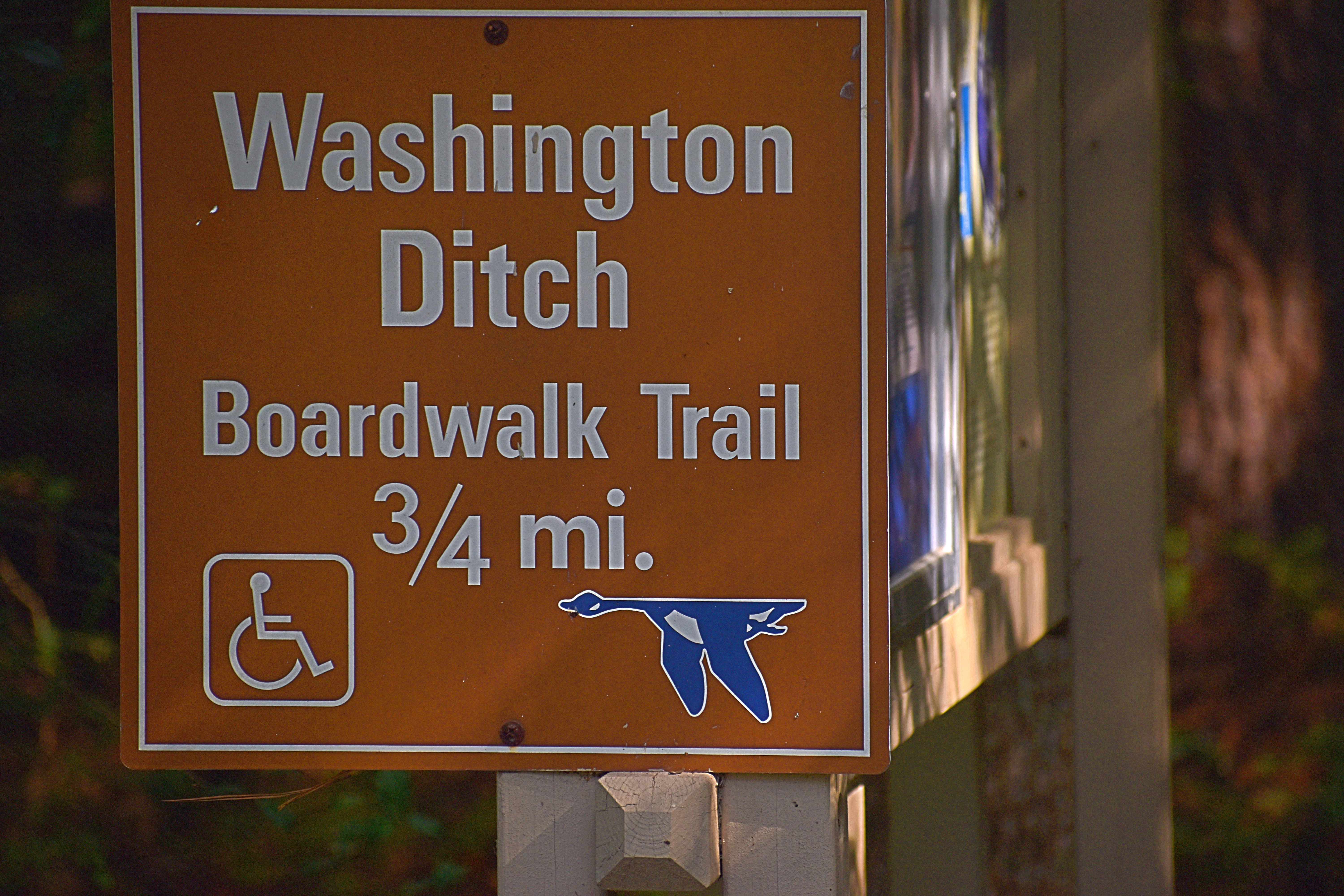
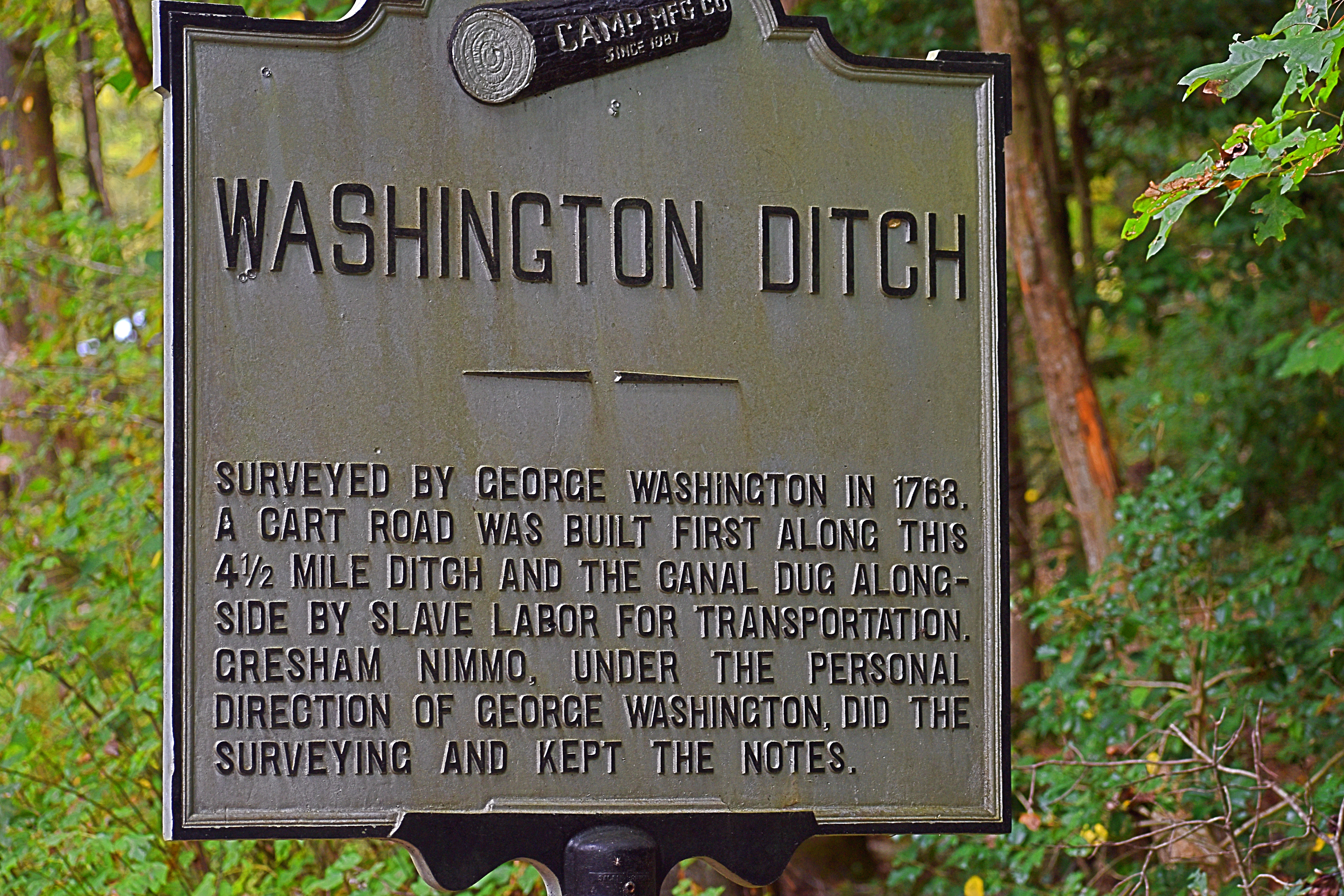
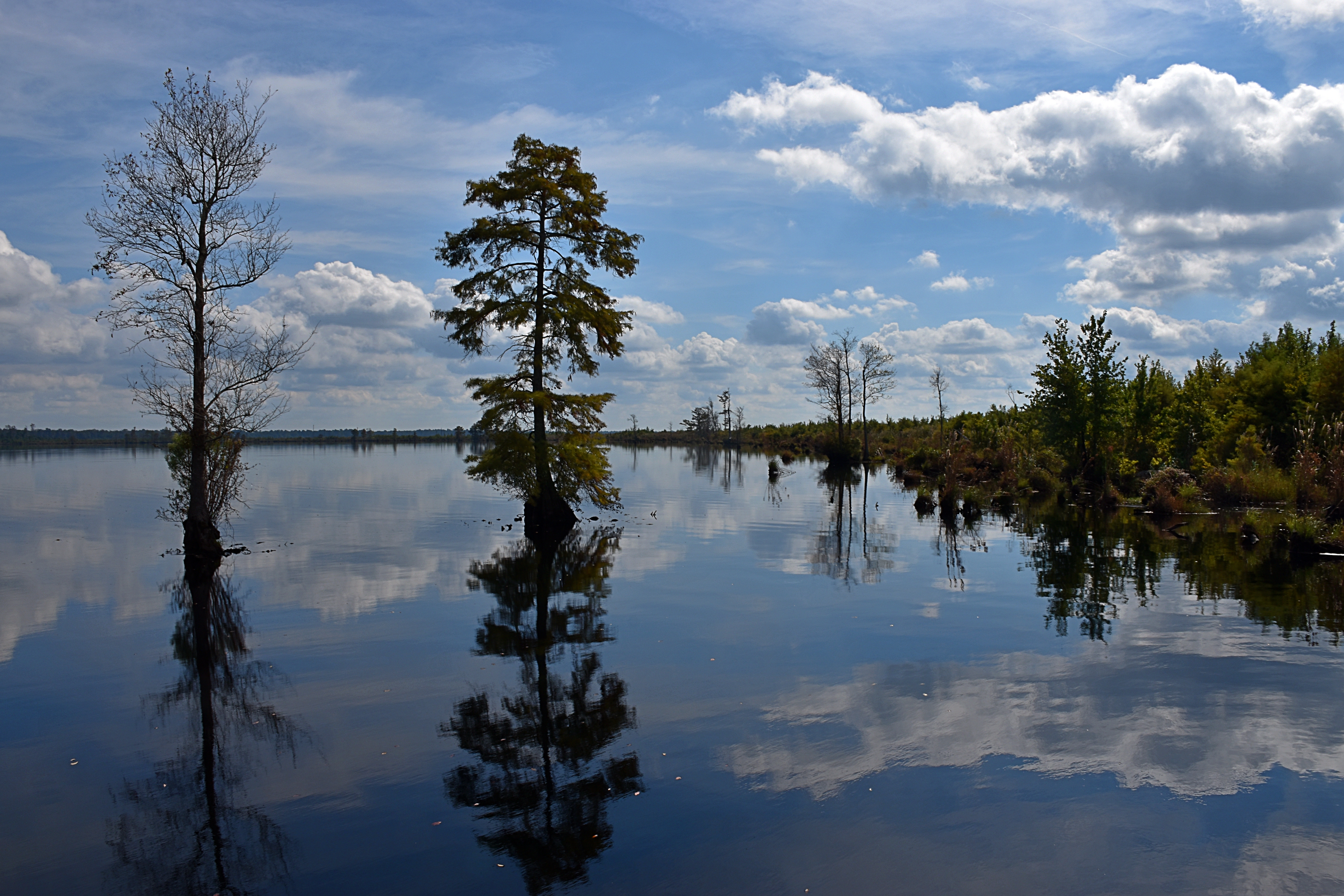
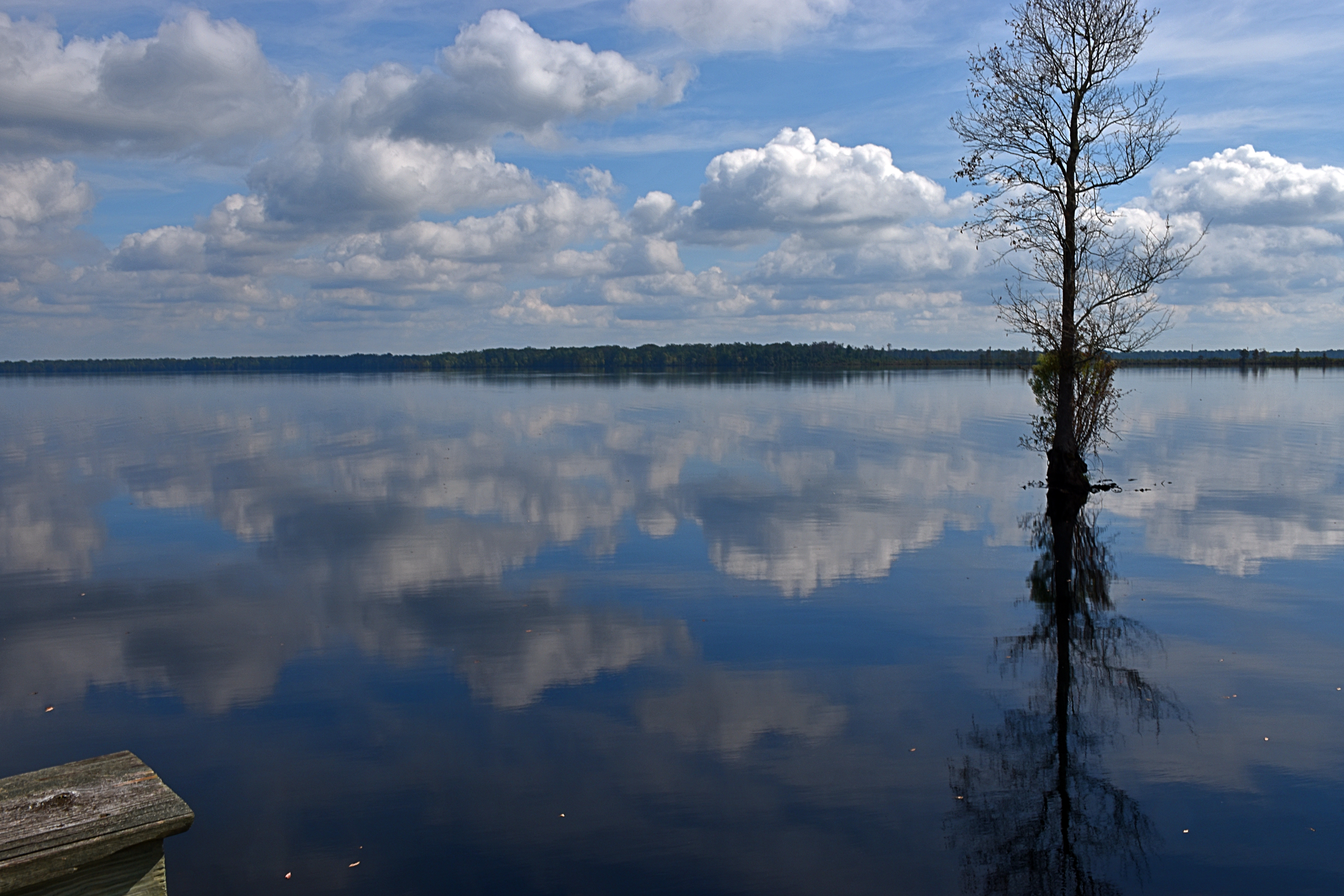
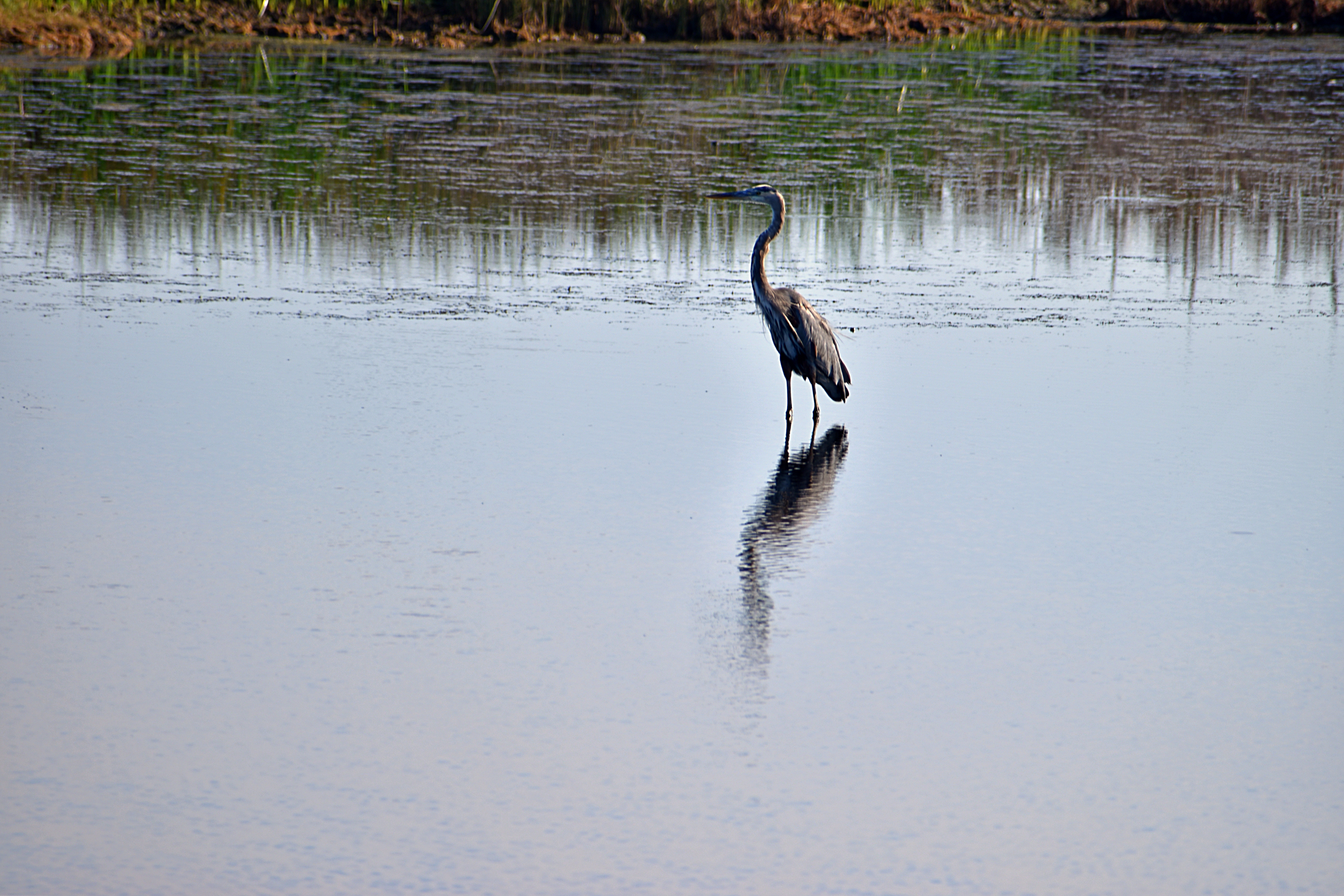
Great Dismal Swamp
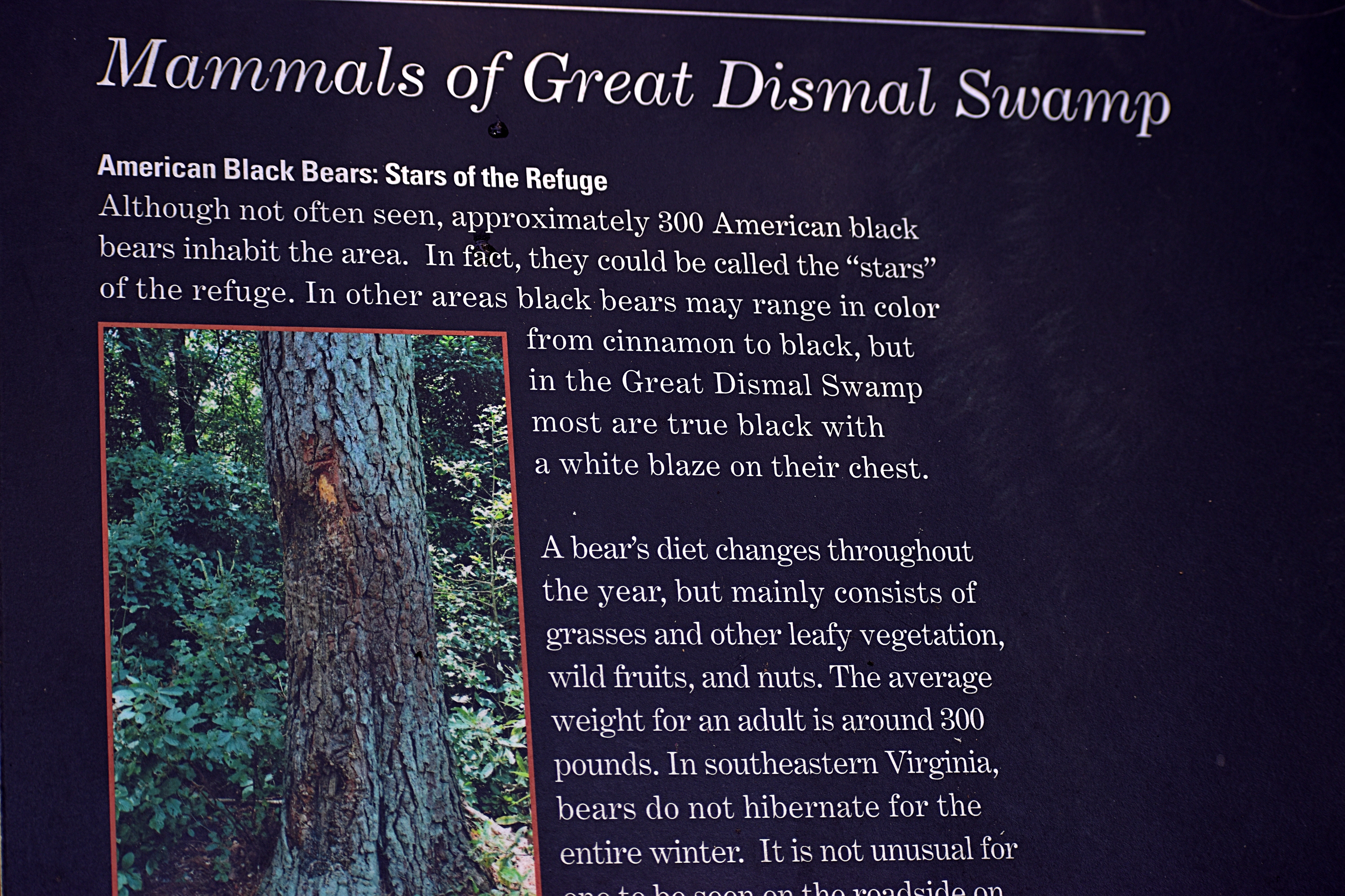
As stated above, I have wanted to visit this place for years. Much of the Swamp is actually in North Carolina. Back in 2008 an unplanned fire started in the GDS as a result of logging operations and burned 4,884 acres over 121 days. Another fire was started in some of the remains in 2011. That fire covered more than 2,000 acres. We happened to be driving down I-95 at the time and recall that the road was engulfed in chocking acrid smoke for many miles. https://www.fws.gov/fire/news/va/southone_final.shtml
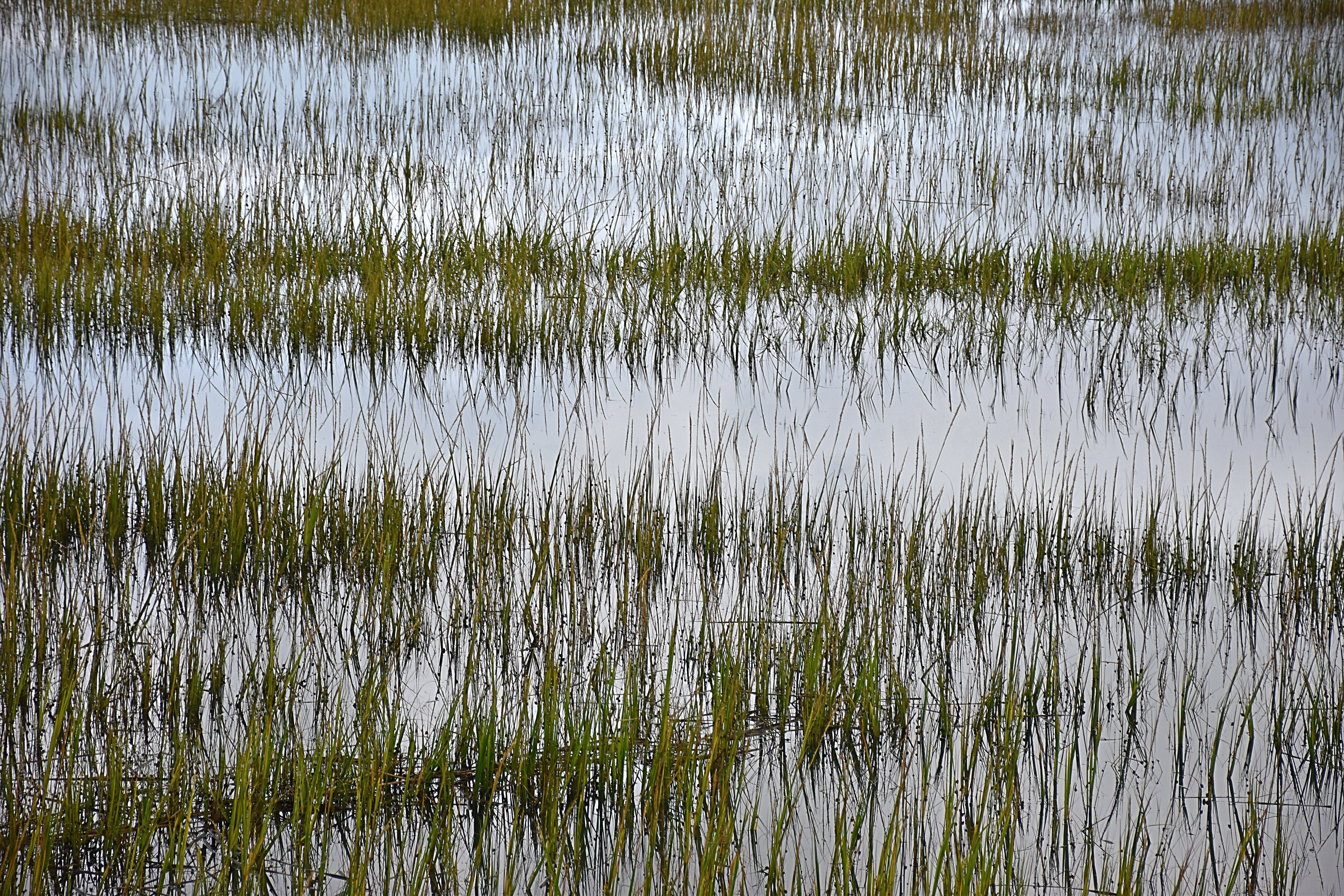
The Great Dismal Swamp is well-named. While there are some boardwalks to permit easy access to some of the interior, the view into the Swamp is imposing. The vegetation, alive and dead, appears to the eye as a tangled impenetrable web of many dead plants. Lots of vines and eerie-looking live things.


One of the most interesting elements of GDS is Lake Drummond, reachable on a hard-pack 6-mile road, a slow but surprisingly easy drive. Lake Drummond is unusual for several reasons. It is underlain by peat, giving the water a spooky dark look. When we were there, there was nary a ripple on the surface.


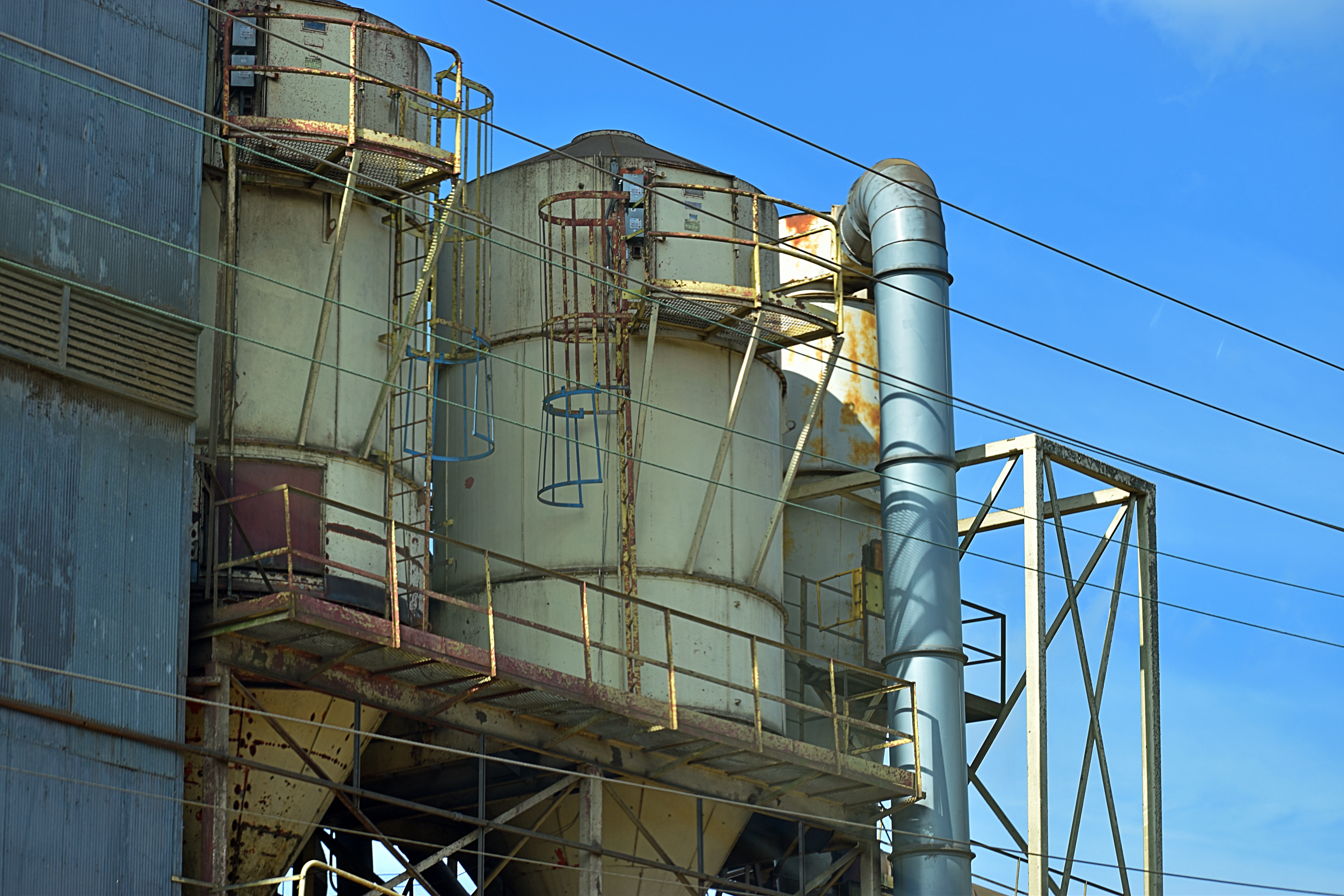
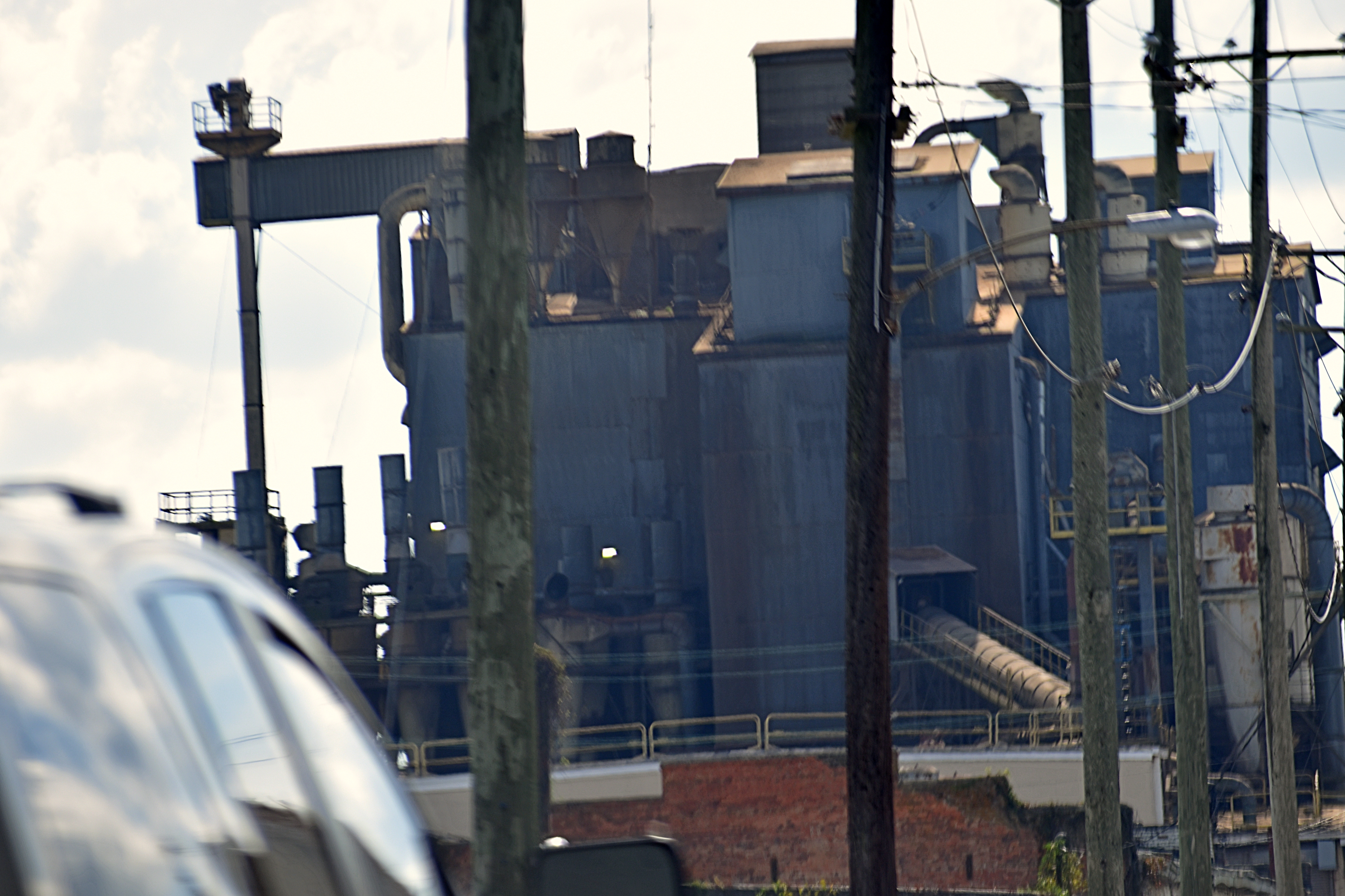
Birdsong Peanuts
After leaving the Swamp, we were startled to see a large “factory” in this place (Suffolk) and stopped briefly for a look. It was in fact a “shelling” facility. The explanation from the company:
Birdsong buys carefully selected peanuts directly from the farmers’ fields. They are then cleaned, shelled, sized and shipped in truckload lots to manufacturers who turn them into many popular food items, from peanut butter to peanut M&M’s. If you eat products made from American peanuts, chances are you’ve consumed peanuts from Birdsong.
Birdsong serves our customers from six shelling plants strategically located throughout the peanut growing area. The plants are supported by over 85 buying points and enough warehouses to store 2.4 billion pounds of Farmers Stock in the shell. We also have enough cold storage, usually ranging from 38° to 42°F, to keep 250 million pounds of shelled peanuts in a controlled environment for our manufacturer customers. [https://www.birdsongpeanuts.com/locations]
Imagine that: 2.4 billion pounds of peanuts.

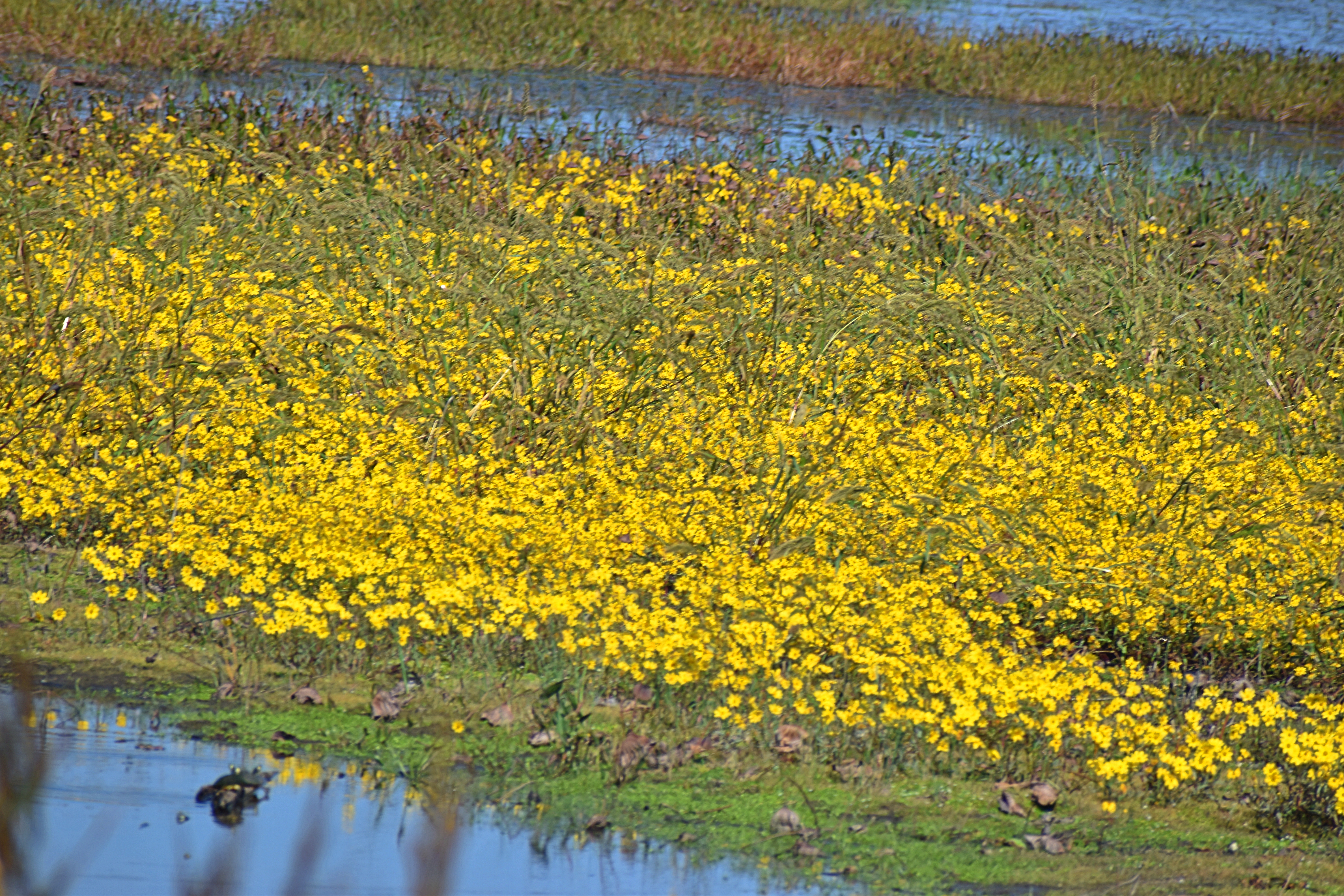
Back Bay & False Cape
Back Bay National Wildlife Refuge
Back Bay National Wildlife Refuge was established on June 6, 1938 as a 4,589-acre refuge to provide feeding and resting habitat for migratory birds. It is a critical segment in the Atlantic Flyway. As the metropolitan area of Virginia Beach began to grow in the 1980’s, the U.S. Fish and Wildlife Service pursued a land acquisition program to double the size of Back Bay NWR [to over 9,250 acres] in order to protect the watershed from harmful development.
Back Bay NWR includes a thin strip of barrier island coastline typical of the Atlantic and Gulf coasts, as well as upland areas on the west bank of Back Bay. Habitats include beach, dunes, woodlands, agricultural fields, and emergent freshwater marshes. The majority of refuge marshes are on islands within the waters of Back Bay.
Thousands of tundra swans, snow and Canada geese and a large variety of ducks visit the refuge during the fall/winter migration. Refuge waterfowl populations usually peak during December and January. [we missed this]
False Cape State Park, comprised of 3,844 acres, sits between Back Bay and the Atlantic Ocean, The Park is one of the last remaining undeveloped areas along the Atlantic coast.
False Cape is unusual in that the park is accessible only by foot, bicycle, tram or boat. Public vehicular access is not allowed at any time.
False Cape features guided kayak trips, primitive camping, interpretive programs, hiking and biking trails, and 6 miles of pristine Atlantic Ocean beach.
The beach extends all the way to North Carolina.
The park operates a tram that leaves from the Back Bay National Wildlife Refuge from April 1 through October 31. The tram runs through the Park’s Barbour Hill area and Wash Woods historic site. Most of the photos that follow were taken from the tram.


First Landing
First Landing is also a Virginia State Park consisting of 2,888 acres. https://bit.ly/3r8zvNg
The Park’s name derives from its remarkable history:
The park is where English colonists first landed in 1607. Native American canoes, Colonial settlers, 20th-century schooners and modern cargo ships have navigated the park’s waterways. Its cypress swamps were a source of fresh water for merchant mariners, pirates and military ships during the War of 1812. Legend has it that Blackbeard hid in the Narrows area of the park, and interior waterways were used by Union and Confederate patrols during the Civil War. Built in part by an all African-American Civilian Conservation Corps in 1933-1940, the park is a National Natural Landmark and is listed in the National Register of Historic Places.
We were surprised that First Landing is Virginia’s most-visited state park, partly because it’s within the boundary of urban Virginia Beach. Despite the ease of access, the park sports 20 miles of trails and 1.5 miles of Chesapeake Bay beach frontage. It includes bald cypress swamps, lagoons and maritime forest, as well as rare plants and wildlife. It even offers cabins and yurts for overnights.
The Park website has this note:
The park is located beside a military training center that operates year-round in any weather at any time of day or night. Park guests may experience unusual sights and loudness. Nighttime training may last even beyond midnight. The activities pose no risk to park guests.
We did not notice this while at the Park, but it was different story in Virginia Beach proper. More on that shortly.


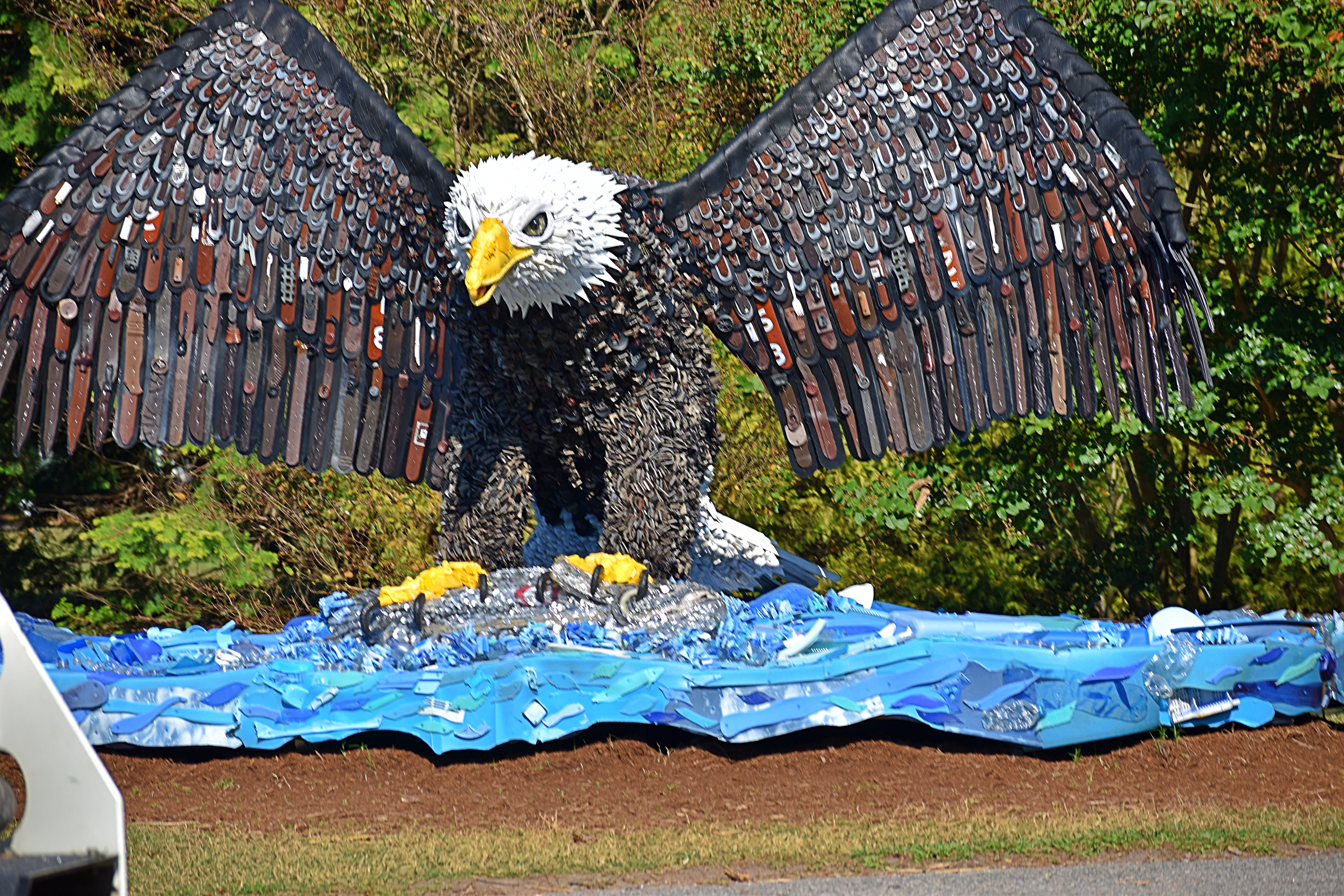
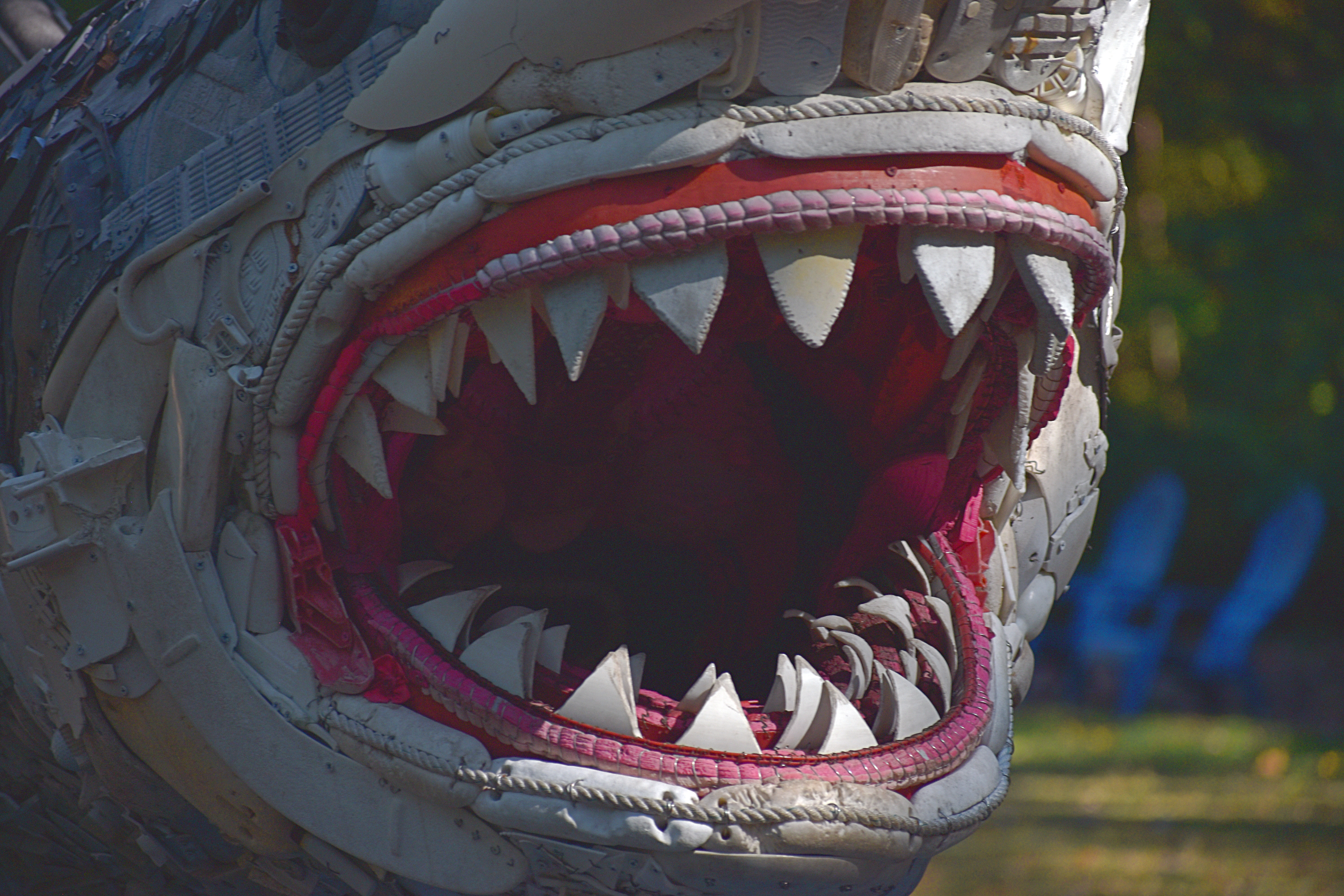
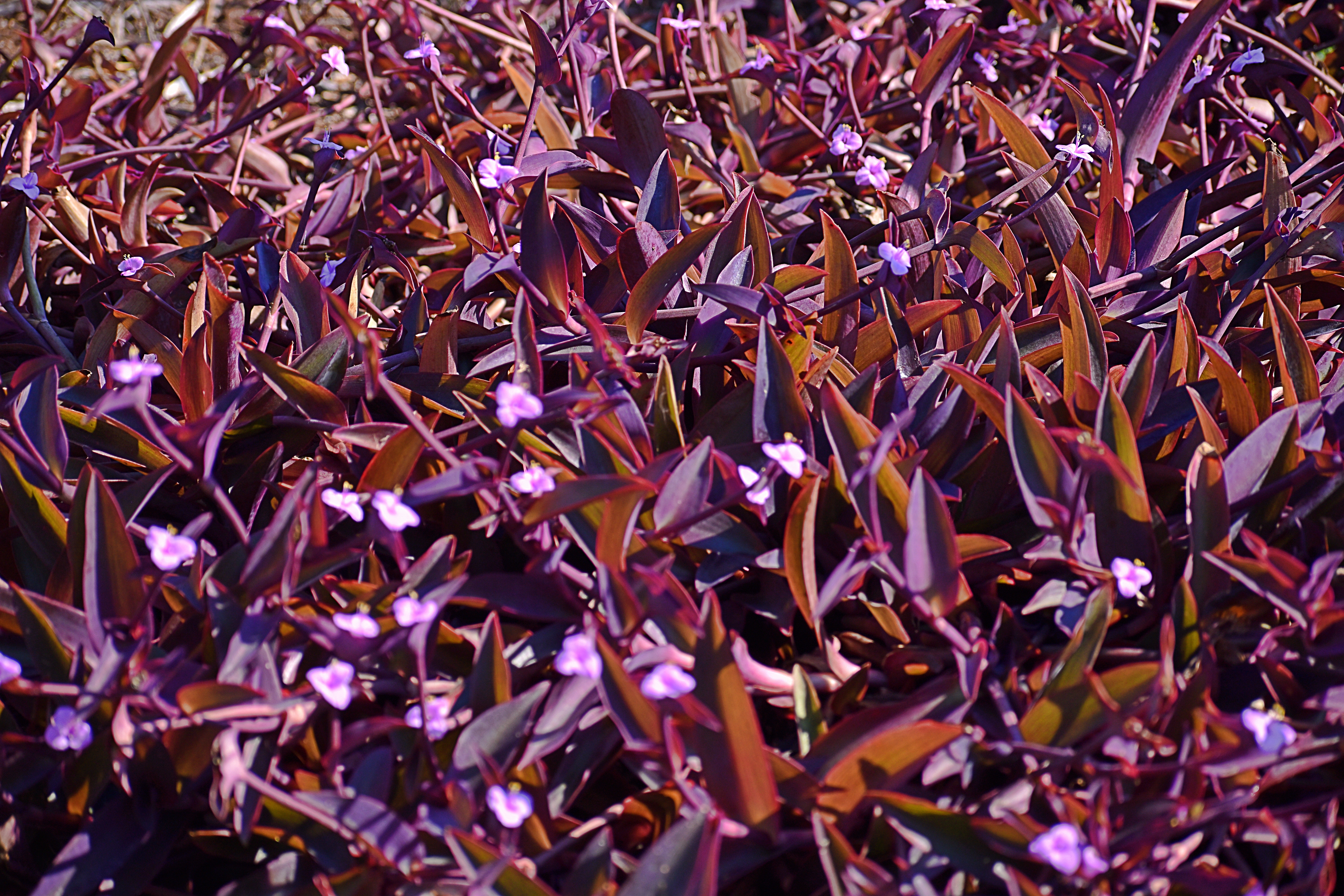
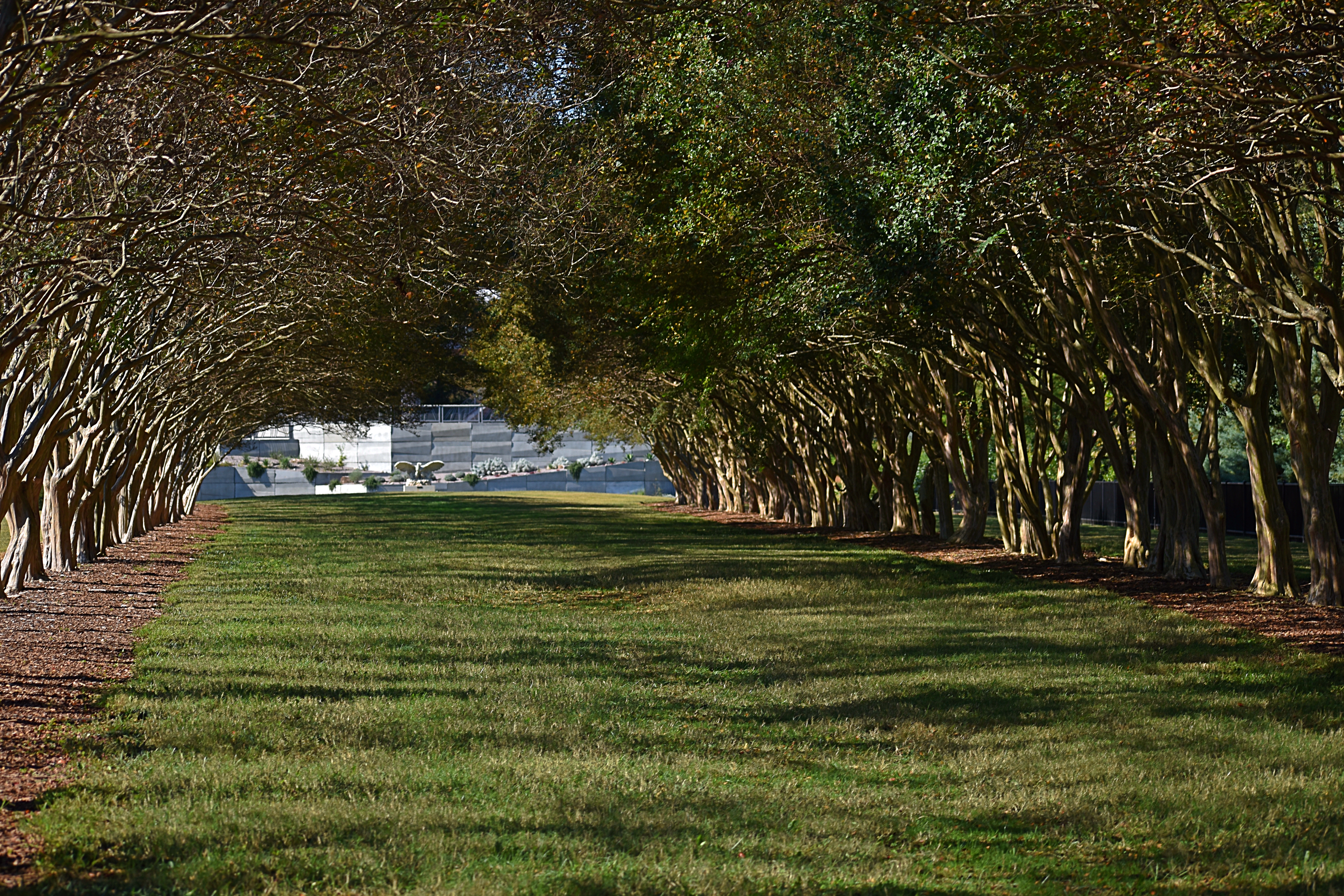
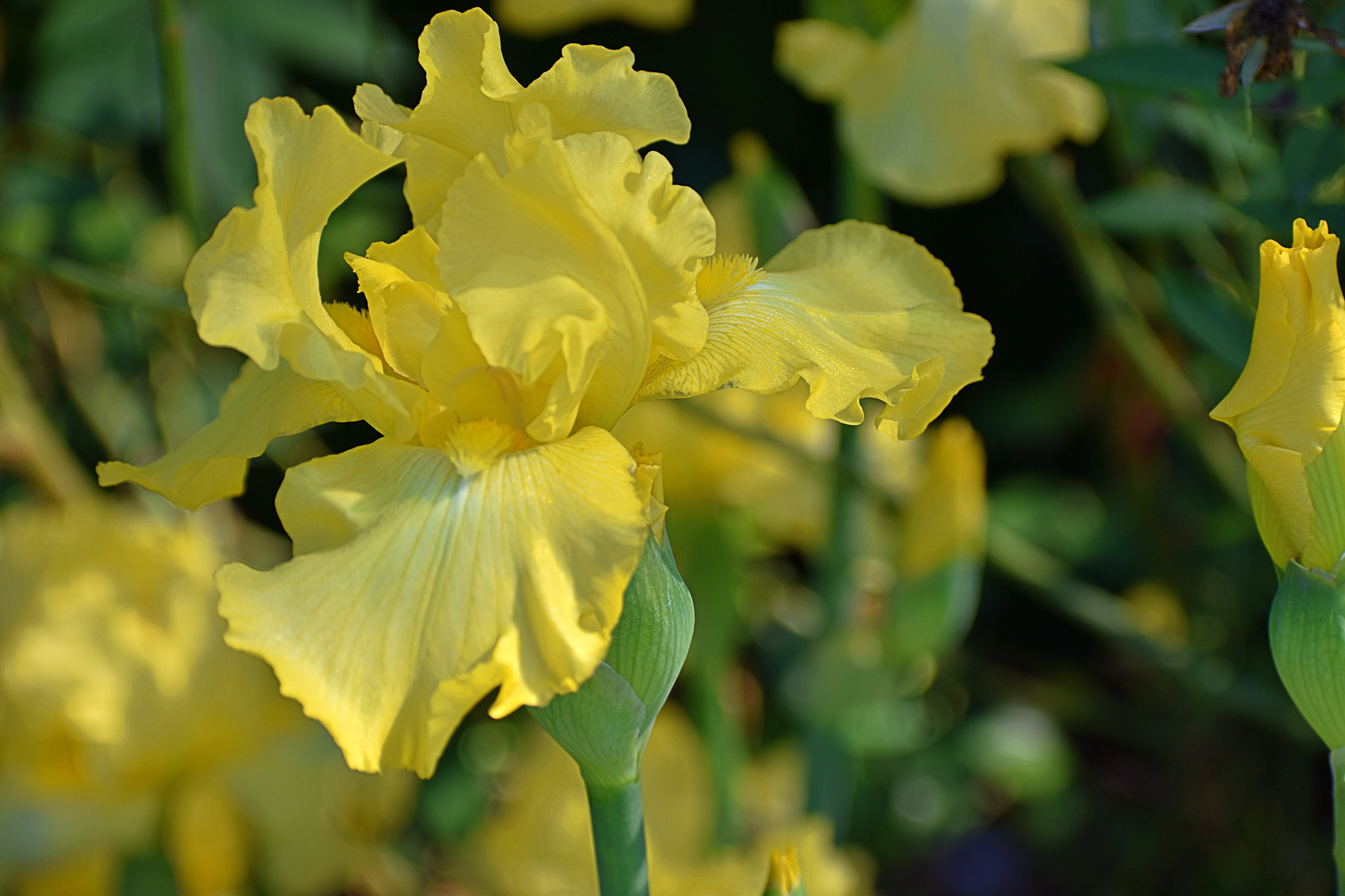
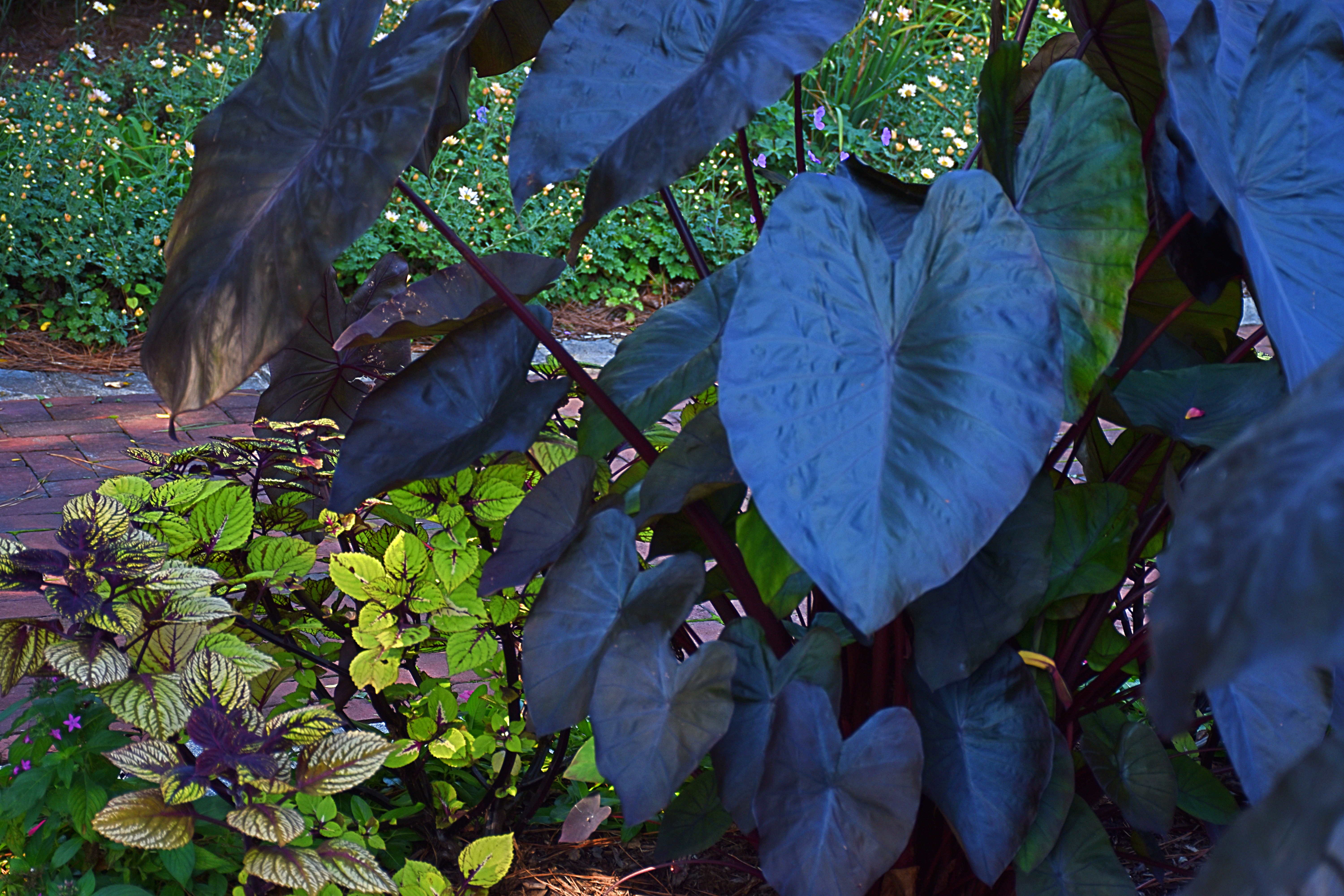
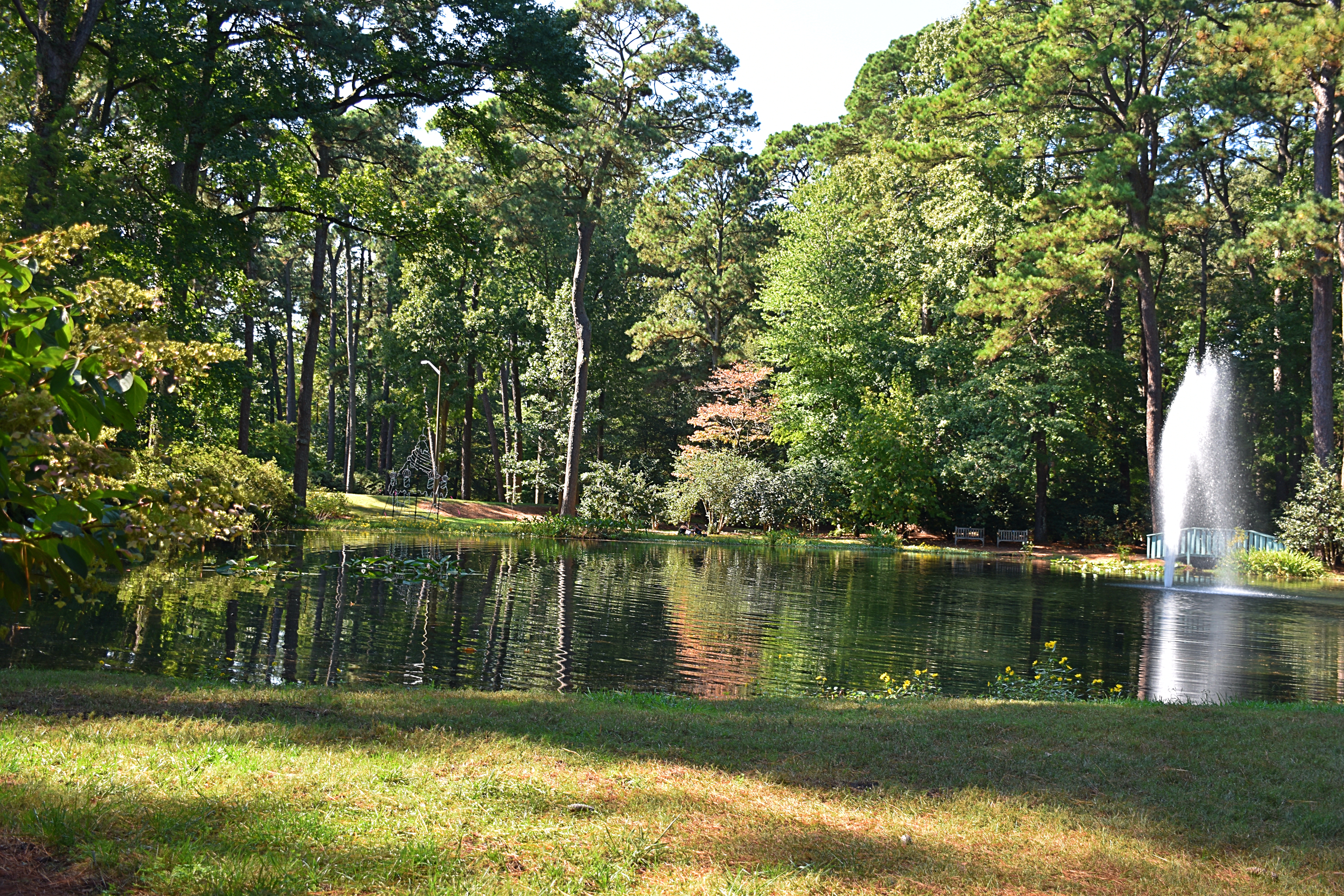
Norfolk Botanical Garden
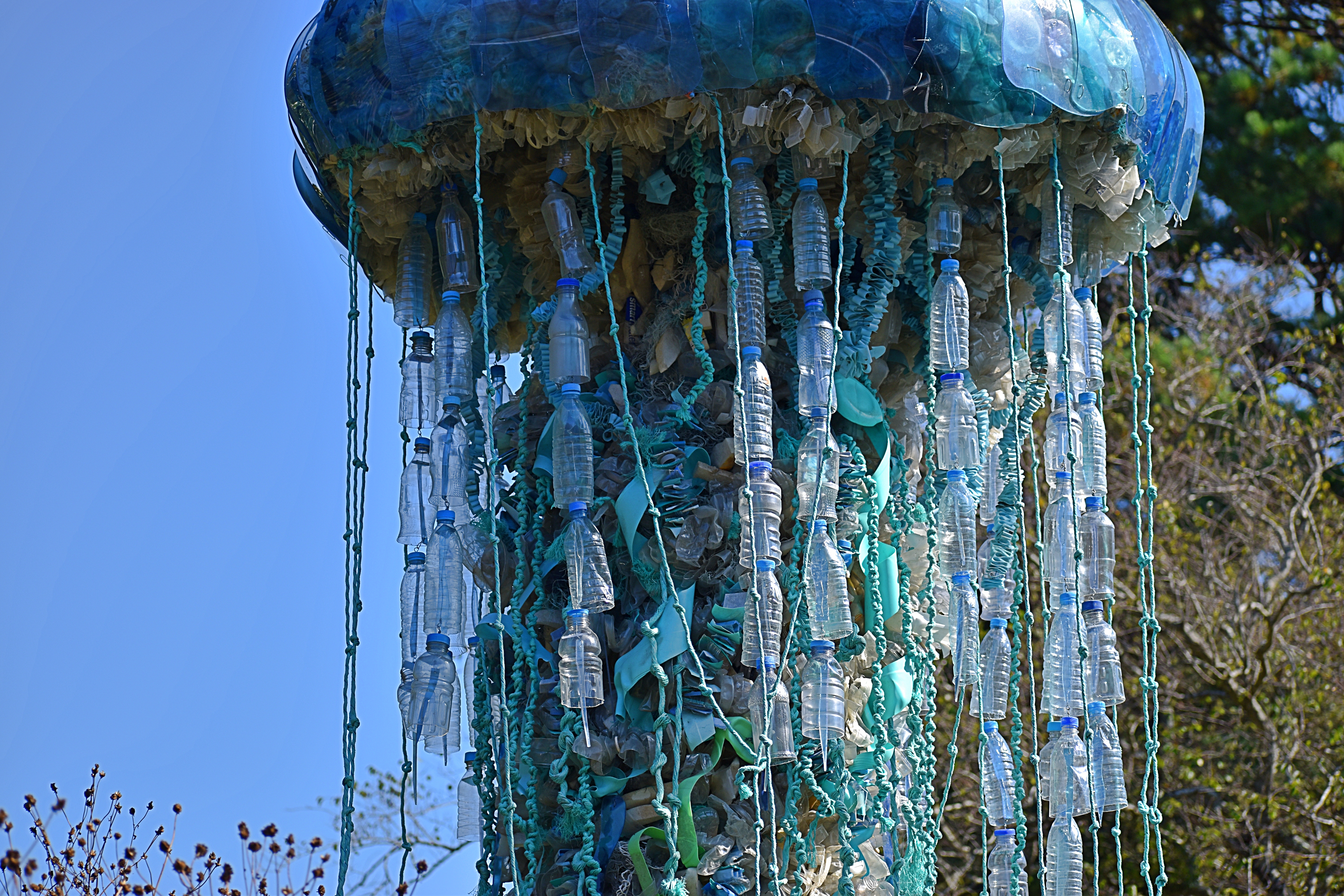
The last major stop on our tour, these gardens, in many ways, turned out to be one of the highlights of our trip. The gardens are vast, with a huge variety of plants, many stunning flower plots, a nice tram ride around the major elements and generally a carefully planned and well-tended diverse display of plant life and some other features we did not expect.
The sculptures are made of materials dredged from the ocean, evidence of the catastrophic impact that humans are having by allowing plastic to enter the water.
The pictures speak for themselves. We highly recommend this place if you’re in the area.


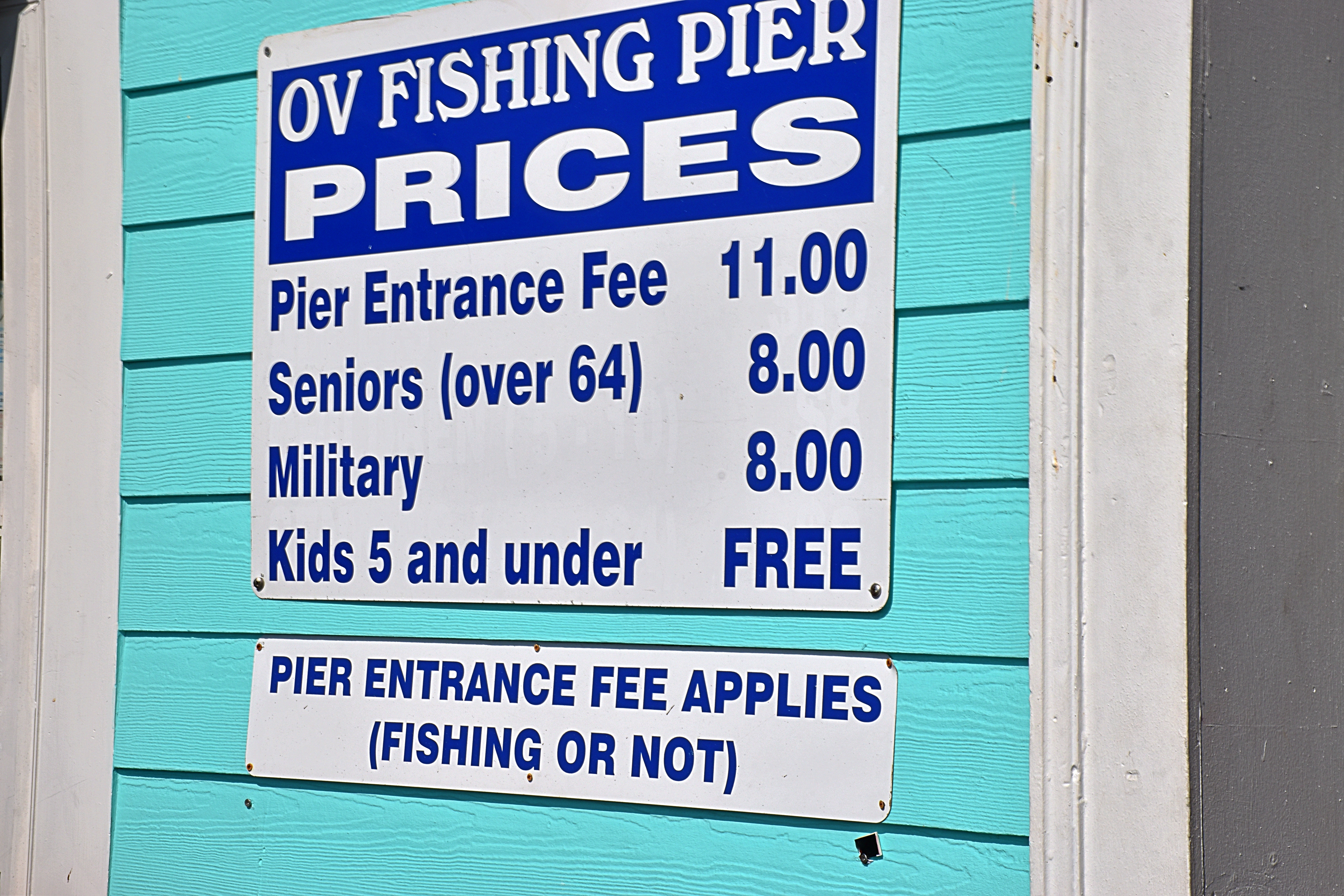
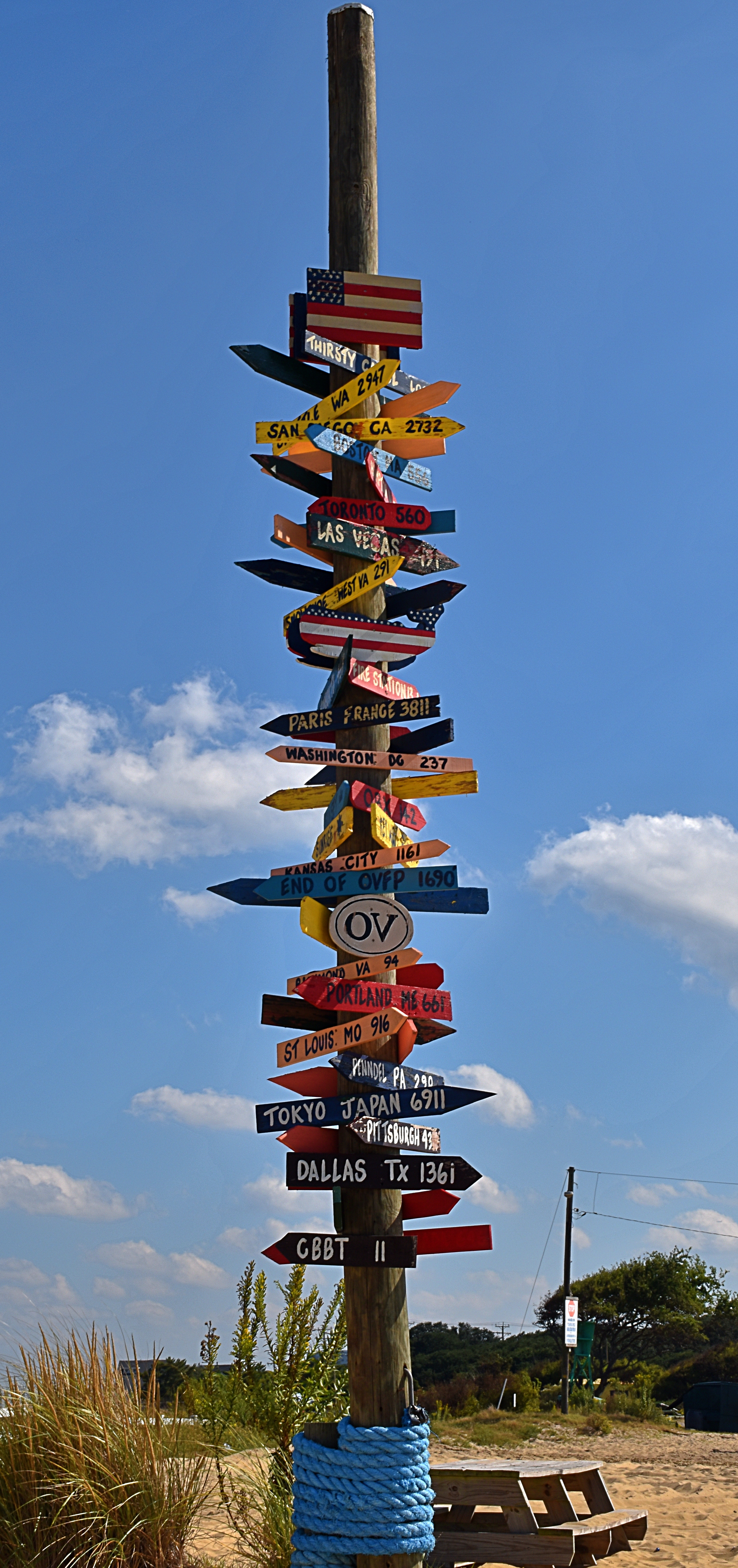
Ocean View Pier [Comic Relief]
As our touring wound down, we were more than a little hungry. We somewhat randomly ended up at the Ocean View Pier . It was, to say the least, an interesting place. The food was surprisingly good but be aware that they allow smoking on the top deck. These photos also speak for themselves.


Virginia Beach
Our story cannot end without a closing comment or two about Virginia Beach.
I mentioned the warning at First Landing about the military base. At our hotel in Virginia Beach, we were periodically stunned into silence by the truly ear-splitting roar of jet fighters coming and going. They apparently needed to attain altitude as fast as possible, resulting in deafeningly loud jet blasts that overwhelmed every other sound. A bit unreal. Not sure how the locals can stand it, but they do.
We were also “treated” to a crazy storm that swept down the length of the beach our last evening. The photo does not do it justice. It led to an evening of torrential downpours, defeating our plan to eat dinner outside and, well, it’s not a good story.


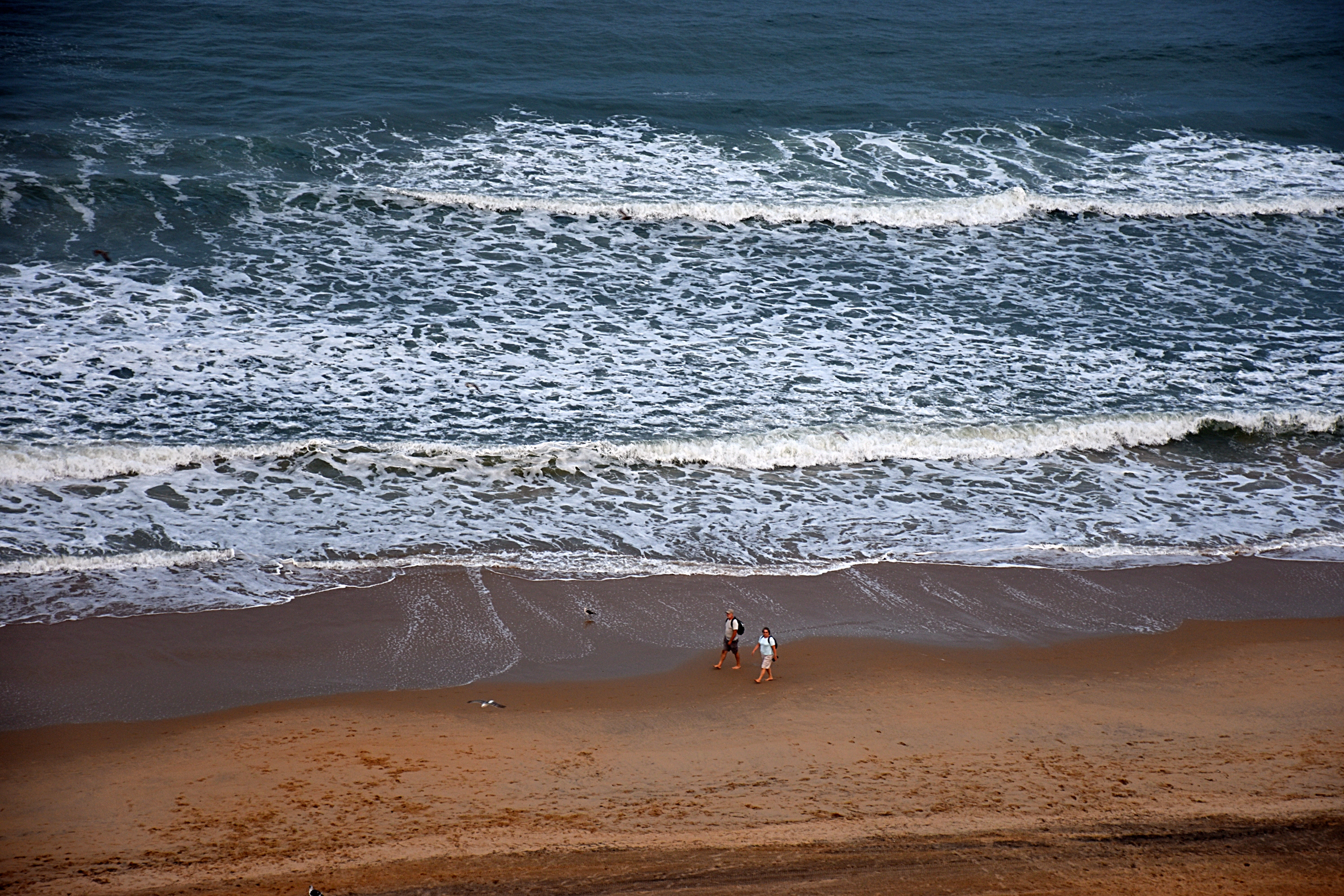


Overall, we saw many interesting sights on this trip, not including Virginia Beach itself, which was largely deserted, especially at night. We recommend the parts of it noted above. There is nothing more to say about that.
Happy Thanksgiving.
The End.

Thank you, Paul. This was so much fun to read, and the photo compositions are compelling. I like the geometry of the one where Dina (?) is crossing the zigzagging bridge. And it always warms my heart when someone used the word “comprise” properly. 🙂
LikeLike